Data Availability Notes

  • Event predates dual-polarization radar deployment (2013-04-01); CC/ZDR products not available.
SWX
Severe Weather Event Reporter
EVENT REPORT CITY OF BINGHAMTON, BROOME COUNTY, NEW YORK, 13905, UNITED STATES

2011 FLOOD - BINGHAMTON NEW YORK

September 07, 2011

The event narrative is AI-generated from structured meteorological data and may contain errors. Verify critical facts against the NCEI, NWS, and LSR data sections below.

IMPACT SUMMARY
Fatalities
9
direct deaths (all hazards)
Max Reflectivity
75.0
dBZ
Echo Tops
65.5
kft (18 dBZ)
Warnings
N/A
not retrieved for this event type
Storm Reports
61
LSRs filed
Property Damage
$1,351,136,500
NCEI estimated (all hazards) · may include overlapping basin totals
PRE-EVENT SOUNDING & VAD WINDS ALB 2011-09-07

Skew-T Log-P

Pre-event sounding

Ambient Hodograph (Event-Time)

Ambient Hodograph
CAPE
73
J/kg
CIN
-10
J/kg
0-6km Shear
52
knots
Sfc Temp
17.8
°C
Sfc Dewpoint
15.1
°C
Sfc Pressure
1010.0
hPa
0-1km SRH
-7
m²/s²
0-3km SRH
211
m²/s²

Skew-T: nearest pre-event balloon launch from ALB - Source: IEM RAOB Archive / University of Wyoming. Hodograph derived from VAD winds extracted from event-time radar velocity data.

EVENT NARRATIVE

Overview

From September 6 to September 8, 2011, the remnants of Tropical Storm Lee interacted with a stalled frontal boundary and moisture from Hurricane Katia to produce an extreme, multi-day heavy rainfall event across central New York and northeast Pennsylvania. This event resulted in catastrophic flash flooding and record-breaking river flooding throughout the upper Susquehanna River Basin. A total of 146 NCEI records were documented for this event, with 9 direct deaths reported across the region.

Environmental Context

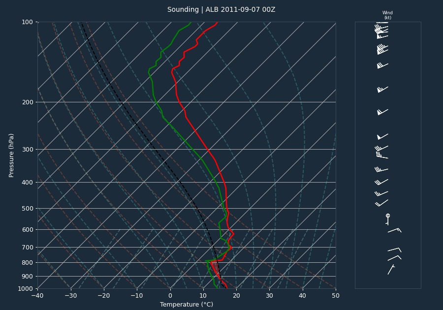
The flooding was driven by a complex meteorological scenario where the remnants of Tropical Storm Lee moved northward from the southern Appalachians, stalling over the Mid-Atlantic region by September 8. This system interacted with a frontal boundary and deep tropical moisture drawn in from Hurricane Katia. This interaction produced a prolonged period of heavy rainfall, with 48-hour totals of 6 to 12 inches common across the upper Susquehanna River Basin. Many climate sites, including Harrisburg (KMDT) and Williamsport (KIPT), recorded their wettest year on record in 2011, with both sites setting all-time 24-hour rainfall records for September on September 7, 2011, receiving 7.71 and 6.76 inches, respectively.

Storm Evolution

Radar data from the KBGM site between September 7 and September 8, 2011, consistently showed high reflectivity values, frequently reaching the 75 dBZ cap. Echo tops remained elevated throughout the event, with 18 dBZ tops frequently exceeding 40,000 feet and reaching as high as 65,500 feet at 18:10 UTC on September 7. The persistent nature of these high-reflectivity cores, combined with the synoptic-scale forcing, supported the extreme rainfall rates that led to the widespread flooding.

Warnings Issued

There were no warnings listed in the provided data for this event.

Impacts

The impacts of this flood were severe and widespread, with damages in the upper Susquehanna River Basin estimated at nearly $1 billion. Record-breaking crests were observed on the Susquehanna River and its tributaries, often exceeding previous records set in June 2006 or the historic Hurricane Agnes flood of 1972.

  • Broome County, NY: Catastrophic flash flooding occurred in Binghamton, Vestal, Endicott, and Endwell. The Susquehanna River at Binghamton crested at 25.71 feet on September 8, topping levees and causing extensive downtown flooding. Property damage in Broome County was significant, with $170 million in damage recorded in Binghamton and $160 million in Vestal.
  • Tioga County, NY: Record flooding occurred along the Susquehanna River near Waverly, cresting at 26.67 feet on September 8. Catastrophic flash flooding was reported in Owego, Nichols, and Apalachin, with $70 million in property damage in Owego and $25 million in Apalachin.
  • Dauphin County, PA: Widespread flooding resulted in $150 million in property damage. The Susquehanna River at Harrisburg crested at 25.17 feet. Four deaths were reported in the county, including a 70-year-old man in Derry Township and an 81-year-old man in Middle Paxton Township.
  • Lancaster County, PA: Three deaths were reported, including a 62-year-old woman and an 8-year-old boy. The Susquehanna River at Marietta crested at 58.16 feet. A total of 189 water rescues were performed, and 1,782 structures were impacted.
  • Luzerne County, PA: Record flooding on the Susquehanna River at Wilkes-Barre reached 42.66 feet on September 8, exceeding the previous record from Hurricane Agnes. Property damage was estimated at $43.5 million.
  • Schuylkill County, PA: Extensive flooding in Pine Grove resulted in $4.1 million in public facility damage. National Guard assistance was required for evacuations, and 741 structures were impacted.

Conclusion

The remnants of Tropical Storm Lee produced a historic flood event across the Susquehanna River Basin. The combination of extreme rainfall totals and saturated antecedent soil conditions led to record-breaking river crests and catastrophic flash flooding. The event resulted in 9 direct deaths and nearly $1 billion in damages across the affected counties in New York and Pennsylvania.

EVENT MAP

Tornado Warning Severe Thunderstorm Warning Tornado Track (DAT/NCEI) LSR

Disclaimer: Tornado tracks use NWS DAT surveyed geometry when available, otherwise NCEI start/end coordinates as straight lines. Actual paths may curve. Width corridors are based on maximum reported width and are approximate.
RADAR LOOP 20 FRAMES
FRAME 01 OF 20 2011-09-07T04:03:37
Base Reflectivity & Velocity (0.5°) - Click image to view all frames
VOLUME SCAN ANALYSIS 20 VOLUMES
Time (UTC) Max dBZ Max Z (kft) 18 Top 50 Top Vel In Vel Out
2011-09-07T04:03:37 75.0 10.5 30.3 18.7 -59.3 59.3
2011-09-07T05:31:02 75.0 18.7 36.9 27.7 -58.3 59.3
2011-09-07T06:57:29 75.0 19.1 35.7 19.9 -59.3 56.4
2011-09-07T08:29:45 75.0 18.7 40.0 18.7 -58.3 59.3
2011-09-07T09:56:12 75.0 10.5 36.0 18.7 -55.4 57.3
2011-09-07T11:28:29 75.0 10.5 49.8 18.7 -59.3 58.3
2011-09-07T12:41:32 75.0 10.5 61.9 17.7 -59.3 59.3
2011-09-07T13:46:28 75.0 10.4 47.3 17.6 -55.4 56.4
2011-09-07T14:54:34 75.0 13.8 51.5 17.6 -51.5 55.4
2011-09-07T15:58:22 75.0 13.8 - 17.7 -58.3 55.4
2011-09-07T17:06:25 75.0 10.4 45.2 19.6 -51.5 51.5
2011-09-07T18:10:09 75.0 27.8 65.5 27.8 -64.1 62.2
2011-09-07T19:13:51 75.0 17.6 64.9 21.3 -51.5 53.5
2011-09-07T20:21:50 75.0 17.5 57.1 24.7 -51.5 61.2
2011-09-07T21:26:35 61.5 13.8 44.2 17.6 -51.5 51.5
2011-09-07T22:34:35 54.0 None 59.6 13.6 -56.4 55.4
2011-09-07T23:38:17 75.0 17.6 60.2 20.8 -51.5 51.5
2011-09-08T00:41:54 75.0 10.5 55.5 17.6 -58.3 54.4
2011-09-08T01:49:51 75.0 13.8 46.8 17.6 -51.5 59.3
2011-09-08T02:53:31 75.0 17.5 49.3 22.9 -57.3 50.5
LOCAL STORM REPORTS 61 REPORTS
18:02 UTC (2:02 PM EDT) FLOOD TOWANDA

STATE OF EMERGENCY IN BRADFORD COUNTY. MAJOR FLOODING. MANY ROADS CLOSED. EVACUATIONS.

15:29 UTC (11:29 AM EDT) FLOOD ENDICOTT

ENJOIE GOLF COURSE 50 PERCENT FLOODED

15:34 UTC (11:34 AM EDT) FLOOD ENDICOTT

EVACUATIONS DUE TO FLOODING

17:11 UTC (1:11 PM EDT) FLOOD BINGHAMTON

STATE OF EMERGENCY IN BROOME COUNTY. MAJOR FLOODING OCCURRING ACROSS MANY SECTIONS OF THE COUNTY. ROADS CLOSED. HOMES EVACUATED.

11:43 UTC (7:43 AM EDT) FLOOD VAN ETTEN
09:30 UTC (5:30 AM EDT) FLOOD CALLICOON

WATER OVER ROUTE 52 IMPASSABLE

13:15 UTC (9:15 AM EDT) FLOOD 1 W CANDOR

1 MILE WEST OF CANDOR ON ROUTE 96

14:08 UTC (10:08 AM EDT) FLOOD APALACHIN

BASEMENTS FLOODED...POWER OUTAGES...PENNSYLVANIA AVE IMPASSABLE

13:54 UTC (9:54 AM EDT) FLOOD SPENCER

EAST SPENCER ROAD NOT PASSABLE FROM OWL CREEK ROAD EAST

12:49 UTC (8:49 AM EDT) FLOOD OWEGO

ROUTE 17 IS CLOSED FROM EXIT 70 IN JOHNSON CITY TO EXIT 60 IN WAVERLY

12:15 UTC (8:15 AM EDT) FLOOD SPENCER
15:15 UTC (11:15 AM EDT) FLOOD ITHACA

YARDS FLOODED AND WATER IN BASEMENTS IN THE 100 BLOCK OF PARK PLACE

20:45 UTC (4:45 PM EDT) FLASH FLOOD 1 ENE ROME

MAJOR FLOODING IN BRADFORD COUNTY ROUTES 220 AND 187...AND NUMEROUS COUNTY ROADS CLOSED AND SEVERAL TOWNS UNACCESSIBLE. STUDENTS ARE UNABLE TO LEAVE NORTH BRADFORD HIGH SCHOOL AND EVACUATIONS UNDERWAY IN SEVERAL COMMUNITIES.

19:30 UTC (3:30 PM EDT) FLASH FLOOD TOWANDA

NUMEROUS ROADS CLOSED IN THE TOWANDA AREA.

15:36 UTC (11:36 AM EDT) FLASH FLOOD WINDHAM CENTER

ROUTE 187 FLOODED.

19:30 UTC (3:30 PM EDT) FLASH FLOOD WYSOX

ROUTE 6 IS CLOSED BETWEEN WYSOX AND WYALUSING.

18:20 UTC (2:20 PM EDT) FLASH FLOOD MONROETON

RTE 220...RTE 414 AND RT6 ARE ALL CLOSED DUE TO FLASH FLOODING. THESE ARE ALL THE MAIN ROADS THROUGH MONROETON.

14:54 UTC (10:54 AM EDT) FLASH FLOOD 1 S CASTLE CREEK

BROOKS RD FLOODED NEAR FOX RD.

20:00 UTC (4:00 PM EDT) FLASH FLOOD BINGHAMTON

I-88 EAST BETWEEN EXIT 2 AND EXIT 3 IS CLOSED DUE TO A LANDSLIDE WITH TREES INVOLVED.

19:25 UTC (3:25 PM EDT) FLASH FLOOD CASTLE CREEK

IN THE TOWN OF CASTLE CREEK ... CREEK IS WELL OVER BANK AND IS FLOODING HOMES IN THE TOWN

17:23 UTC (1:23 PM EDT) FLASH FLOOD 3 NNW GLEN AUBREY

LEEKVILLE RD WASHOUT

23:00 UTC (7:00 PM EDT) FLASH FLOOD 2 SSE WHITNEY POINT

MULTIPLE ROADS CLOSED AND OR WITH WATER OVER THEM IN THE TOWN OF BARKER.

19:35 UTC (3:35 PM EDT) FLASH FLOOD GLEN AUBREY

NANTICOKE CREEK FLOODING ROADS AND THREATENING HOMES.

16:30 UTC (12:30 PM EDT) FLASH FLOOD WEST CORNERS

NANTICOKE CREEK IS OUT OF ITS BANKS FLOODING NEIGHBORHOOD ALONG RIVER DRIVE.

14:31 UTC (10:31 AM EDT) FLASH FLOOD BINGHAMTON

NUMEROUS STREETS AND ROADS FLOODED AND CLOSE. DEEP PONDING OF WATER IN UNDERPASSED. THIS INCLUDE THE ENTIRE TRIPLE CITIES AREA.

19:21 UTC (3:21 PM EDT) FLASH FLOOD MAINE

ROUTE 26 JUST NORTH OF THE TOWN OF MAINE...APPROXIMATELY 3 FEET OF WATER WAS IN A COUNTRY STORE AND JUST SOUTH OF MAINE... APPROXIMATELY 4 FEET OF WATER OVER ROUTE 26

03:38 UTC (11:38 PM EDT) FLASH FLOOD VESTAL

ROUTE 434 IN VESTAL IS COMPLETELY FLOODED BOTH LANES BY OLD OWEGO ROAD NEXT TO CHUCKSTERS MINIATURE GOLF.

15:00 UTC (11:00 AM EDT) FLASH FLOOD 1 W GLEN CASTLE

WEST CHENANGO RD FLOODED NEAR RT 11.

15:12 UTC (11:12 AM EDT) FLASH FLOOD GREENE

COUNTY RD 32 IN GREENE TWP. CLOSED DUE TO WATER OVER THE RD.

15:01 UTC (11:01 AM EDT) FLASH FLOOD COVENTRY

NUMEROUS ROADS FLOODED.

20:51 UTC (4:51 PM EDT) FLASH FLOOD 4 S GREENE

PAGE BROOK ROAD IS FLOODED AT THE CHALKER CREEK CULVERT. CHALKER CREEK HAS BREACHED THE CULLVERT AND IS FLOWING DOWN THE ROAD .

21:36 UTC (5:36 PM EDT) FLASH FLOOD NORWICH

STATE OF EMERGENCY IN CHENANGO COUNTY. ROADS WILL BE REMAINED CLOSED UNTIL FURTHER NOTICE.

15:30 UTC (11:30 AM EDT) FLASH FLOOD GREENE

STREAMS OVER ROADS AND BRIDGES.

19:45 UTC (3:45 PM EDT) FLASH FLOOD NORWICH

WILLARD COURT FLOODED. 30 TO 40 PEOPLE EVACUATED.

19:55 UTC (3:55 PM EDT) FLASH FLOOD WILLET

FLASH FLOODING OF STREAMS AND CREEKS. ROAD CLOSURES.

06:34 UTC (2:34 AM EDT) FLASH FLOOD WILKES-BARRE

WIDESPREAD FLOODING WITH SOME EVACUATIONS BEGINNING

20:25 UTC (4:25 PM EDT) FLASH FLOOD ONEONTA

NUMEROUS ROADS FLOODED. SUNY ONEONTA ALMOST CUT OFF ON THE HILL ABOVE THE FLOODING.

19:45 UTC (3:45 PM EDT) FLASH FLOOD OTEGO

WATER RESCUES. NUMEROUIS ROADS CLOSED. STATE OF EMERGENCY IN OTSEGO COUNTY.

21:00 UTC (5:00 PM EDT) FLASH FLOOD 2 S WATKINS GLEN

ROAD FLOODING ON NYS 14 BETWEEN WATKINS GLEN AND MONTOUR FALLS. ONE LANE IS COVERED FOR ABOUT 100 FEET

13:12 UTC (9:12 AM EDT) FLASH FLOOD 1 S LITTLE MEADOWS

BOLLES HILL RD HAS WATER OVER A BRIDGE

19:45 UTC (3:45 PM EDT) FLASH FLOOD RUSH

MANY ROADS FLOODED. RESCUES TAKING PLACE.

18:04 UTC (2:04 PM EDT) FLASH FLOOD LITTLE MEADOWS

NATIONAL GUARD BEING CALLED IN TO RESCUE TRAPPED RESIDENTS.

15:14 UTC (11:14 AM EDT) FLASH FLOOD 1 E NICHOLS

EAST RIVER RD FLOODED AT NICHOLS. WATER IN HOUSES ON EAST RIVER RD NEAR LOUNSBERRY.

15:03 UTC (11:03 AM EDT) FLASH FLOOD 1 NNE OWEGO

LISLE RD NEAR GARY HUNT RD WATER OVER THE ROAD.

16:19 UTC (12:19 PM EDT) FLASH FLOOD OWEGO

NUMEROUS RDS CLOSED DUE TO STREAMS FLOODING OVER ROADS. MAINLY SOUTHERN PART OF THE COUNTY.

17:05 UTC (1:05 PM EDT) FLASH FLOOD NEWARK VALLEY

NUMEROUS ROADS CLOSED DUE TO FLOODING. STREAMS OF THEIR BANKS AND OVER BRIDGES.

14:07 UTC (10:07 AM EDT) FLASH FLOOD SMITHBORO

SMITH CREEK RO AND SULPHER SPRINGS RD HAVE WATER OVER THEM AND IMPASSABLE.

01:00 UTC (9:00 PM EDT) FLASH FLOOD LOUNSBERRY

THE ENGELBERT FARM WHICH IS JUST EAST OF LOUNSBERRY ON EAST RIVER ROAD IS SEVERAL FEET UNDER WATER AND HAS BEEN SINCE MID-AFTERNOON. THERE IS SIGNIFICANT DAMAGE TO EQUIPMENT... BUILDINGS... LIVESTOCK... AND CROPS.

14:11 UTC (10:11 AM EDT) FLASH FLOOD APALACHIN

WATER OVER STREETS AND RUNNING THROUGH PEOPLES YARDS.

23:30 UTC (7:30 PM EDT) FLASH FLOOD ITHACA

FLOODING ON ELLIS HOLLOW ROAD AT EAST HILL PLAZA.

22:54 UTC (6:54 PM EDT) FLASH FLOOD ITHACA

SEVERAL ROADS FLOODING AROUND ITHACA.

16:06 UTC (12:06 PM EDT) FLASH FLOOD TUNKHANNOCK

BOWMANS CREEK FLOODING. THREATENING A HOME.

16:05 UTC (12:05 PM EDT) FLASH FLOOD FORKSTON

STREAMS OVER FLOWING BANKS. ROADS FLOODED.

14:28 UTC (10:28 AM EDT) HEAVY RAIN 1.3 1 SE NORTH FENTON
19:00 UTC (3:00 PM EDT) HEAVY RAIN 3.65 MONROETON

RAINFALL FROM 8 AM TIO 3 PM

11:21 UTC (7:21 AM EDT) HEAVY RAIN 7.42 MONTROSE

STORM TOTAL SO FAR

07:05 UTC (3:05 AM EDT) HEAVY RAIN 7.5 ELMIRA

STORM TOTAL SO FAR

09:02 UTC (5:02 AM EDT) HEAVY RAIN 9 ALBA

STORM TOTAL SO FAR

11:26 UTC (7:26 AM EDT) HEAVY RAIN 10.39 APALACHIN

STORM TOTAL SO FAR

15:53 UTC (11:53 AM EDT) FLOOD MONTOURSVILLE

SLABTOWN BRIDGE HAS COLLAPSED AND A NEARBY RAILROAD BRIDGE IS HEAVILY DAMAGED.

14:28 UTC (10:28 AM EDT) FLOOD DUSHORE

SIGNIFICANT FLOODING IS OCCURING IN DUSHORE.

STORM SURVEY DATA (NCEI) 146 RECORDS
07-SEP-11 08:00:00 Flood DAUPHIN County
4 deaths $150,000,000 property damage

Swatara Creek near Hershey crested at major flood stage, 26.8 feet. Flood stage is 7.0 feet. Swatara Creek at Middletwon crested at major flood stage, estimated at 26.30 feet. Flood stage is 11.0 feet. This is the 5th highest all time.||The Susquehanna River at Harrisburg crested in major flood stage at 25.17 feet. Flood stage is 17 feet. This is the 5th highest crest on record.||While the Susquehanna River flooded a large area of Harrisburg, some areas were fortunate enough to escape the flood waters. Midtown and Uptown residents were largely unscathed, though widespread power outages were reported. The river levels crested several feet below that of Agnes, thanks in part to less contribution from the West Branch of the Susquehanna.||Between 8,000 and 10,000 residents were evacuated. The Shipoke area of downtown reported significant flooding. City Island was also hard hit, with the baseball stadium under at least seven feet of water, prompting the double A baseball team to have to play its playoff games on the road.||Major damage was widespread in Hershey. Hersheypark and ZooAmerica both reported major damage with 8 feet of water in low lying areas of Hershey Park. Many structures were flooded and many roads suffered damage. A ramp off of Route 322 near the Penn State Hershey Medical Center had a 3-foot deep trench cut across the road. Swatara Creek cut a wide and devastating flood path. Evacuations were noted in Palmyra, Derry Township and Middletown.||A 70-year old man died when a basement wall collapsed on him in Derry Township. He was pumping water from his flooded basement. A second man died in flood waters. While details surrounding his death are unknown, his mud covered car and body were found in Swatara Township several days after the flooding. A third man, 81 years old, drowned after his car was washed into Clarks Creek in Middle Paxton Township. Finally, a fourth victim, a 54 year old female, was swept away by flood waters. Her body was recovered weeks later in Swatara Creek.||Water rescues were widespread in Dauphin County. One county rescuer was quoted, ���We were rescuing people on the way to rescuing people,��� Leonard said. ���There was no time for introductions or salutations. We were dispatched every 90 seconds for hours.���||Severe flooding occurred on Spring Creek. House flooding, closed roads and water rescues using boats were conducted in Paxtang Borough and Swatara Township. Three-quarters of all roads were flooded in Derry Township. Middletown on the mouth of Swatara Creek, where it enters the Susquehanna River also reported major flooding. Five of the eighteen homes on Few Avenue were condemned from flood damage. The basements of these homes were visible from the street through giant holes in the foundation. Residents also reported a foul smell after the floods, with one resident saying, ���Imagine the contents of a septic tank mixed with diesel and fuel oil.���||A preliminary total of 295 buildings were destroyed, 1040 suffered major damage, and 1273 suffered minor damage with a total of 3348 structures impacted. Overall damage was estimated at $150 million. In addition, 368 acres of crops were destroyed with an estimated value of $700,000.

08-SEP-11 00:45:00 Flood BERGEN County

In Hasbrouck Heights, all lanes on NJ 17 southbound, north of US 46, were closed due to flooding.

06-SEP-11 21:17:00 Flood BERGEN County

Route 46 was closed in both directions at Main St. in Lodi due to flooding.

07-SEP-11 15:35:00 Flood CHENANGO County
$500,000 property damage

A moderate to major flood occurred on the Chenango river at Greene, NY. The river crested at 21.09 feet at 10:15 AM on September 8, 2011. There was extensive flooding in the town and village of Greene, and surrounding areas.

07-SEP-11 12:26:00 Flood TIOGA County
$16,000,000 property damage

Record flooding occurred along the Susquehanna River near Waverly, NY between September 7th and September 12th, 2011. The river crested at 26.67 feet at 4:15 PM on September 8th as determined by a USGS high water mark survey. This surpassed the previous record of 22.52 feet set during the June 2006 flood.

07-SEP-11 13:20:00 Flash Flood BRADFORD County
$2,000,000 property damage

Catastrophic flash flooding occurred in Monroeton from the Towanda Creek. The levee was destroyed by the flash flooding. Routes 220, 414 and 6 are all closed due to flash flooding. Many homes have been flooded.

07-SEP-11 11:30:00 Flash Flood BROOME County
$50,000,000 property damage

Catastrophic flash flooding occurred along the Nanticoke Creek in West Corners. Numerous roads, homes and bridges were severely damaged.

07-SEP-11 17:16:00 Flood CHENANGO County
$250,000 property damage

A record breaking flood occurred on the Unadilla River near Rockdale on September 8, 2011. The river crested at 14.22 feet at 10:45 AM. Widespread flooding occurred all along the reach of the river. This surpassed the previous record of 13.96 feet set during the June 2006 flood.

07-SEP-11 15:00:00 Flash Flood BROOME County
$500,000 property damage

I-88 east between exit 2 and exit 3 was closed due to a landslide with trees involved.

07-SEP-11 14:30:00 Flash Flood BRADFORD County
$2,000,000 property damage

Numerous roads were closed in the Towanda area due to flash flooding.

07-SEP-11 11:48:00 Flood BENNINGTON County

Minor flooding occurred on the Walloomsac River at Bennington. The Bennington river gage located near Ore Bed Road exceeded its 7 foot flood stage at 11:48 am EST September 7th, crested at 8.57 feet at 2:15 pm (moderate flood stage is 9 feet), and fell below flood stage at 5:54 pm September 7th.

07-SEP-11 12:05:00 Flash Flood TIOGA County
$15,000,000 property damage

Catastrophic flash flooding of roads, bridges and homes occurred in the Newark Valley area. Numerous roads, homes and bridges were severely damaged.

07-SEP-11 16:54:00 Flood TIOGA County
$309,000,000 property damage

A record flood occurred on the Susquehanna river at Owego, NY. The crest was recorded by a high water mark survey at 39.62 feet on September 8, 2011 with an estimated time at about 3:00 PM. This flood smashed the previous record flood event by being nearly 4 feet higher.

07-SEP-11 20:33:00 Flash Flood ONEIDA County
$3,000,000 property damage

The Saquoit creek at the intersection of Sunnyside and Brookline drives exceeded its banks and caused flooding along Brookline drive and across the Bridge on Genesee street on the Utica-New Hartford line.

07-SEP-11 12:26:00 Flood BRADFORD County
$15,300,000 property damage

Record flooding occurred along the Susquehanna River near Sayre and Athens, PA between September 7th and September 12th, 2011. The river crested at 26.67 feet at 4:15 PM on September 8th as determined by a USGS high water mark survey.

07-SEP-11 14:21:00 Flash Flood BROOME County
$5,000,000 property damage

Catastrophic flash flooding occurred in the Town of Maine. Numerous roads, homes and bridges were severely damaged. Three to four feet of water flooded homes.

07-SEP-11 20:28:00 Flood CHENANGO County
$100,000 property damage

A record flood occurred on the Chenango River at Sherburne, NY on September 8, 2011. The river crested at 11.64 feet at 8:15 AM. Widespread major flooding was observed along the reach of the river. This surpassed the previous record of 11.35 feet set during the June 2006 flood.

07-SEP-11 23:26:00 Flood DELAWARE County
$2,000,000 property damage

Moderate flooding occurred on the West Branch Delaware River near Hale Eddy, NY. The river gauge located near Hale Eddy crested at 14.71 feet on September 8, 2011 at 10:45 AM.

07-SEP-11 22:10:00 Flood DELAWARE County

The second round of heavier rain that started on the 7th in Chester County caused additional flooding along the Brandywine Creek. The Brandywine Creek at Chadds Ford had moderate flooding and was above its 9 foot flood stage from 1110 p.m. EDT on the 7th through 326 p.m. EDT on the 8th. It crested at 11.70 feet at 615 a.m. EDT on the 8th. Entire event rainfall totals included 6.35 inches at the Philadelphia International Airport and 4.65 inches in Nether Providence Township.

07-SEP-11 14:58:00 Flood OTSEGO County
$58,000,000 property damage

Major flooding occurred along the Susquehanna River near Unadilla, NY from September 7, 2011 to September 10, 2011. The river crested at 16.34 feet on September 8 at 9:15 PM. The hardest hit area was the village of Sidney, NY which incurred tens of millions of dollars in property damage.

07-SEP-11 08:12:00 Flash Flood SUSQUEHANNA County
$500,000 property damage

Catastrophic flash flooding occurred in Little Meadows from very heavy rains. Numerous roads, homes and bridges were severely damaged.

07-SEP-11 14:25:00 Flash Flood BROOME County
$10,000,000 property damage

Catastrophic flooding occurred in Castle Creek. Numerous roads, homes and bridges were severely damaged.

07-SEP-11 10:36:00 Flash Flood BRADFORD County
$3,000,000 property damage

Catastrophic flash flooding occurred along Route 187. Numerous roads, homes and bridges were severely damaged. A road collapsed from the flooding.

07-SEP-11 07:07:00 Flood DELAWARE County
$2,000,000 property damage

Moderate flooding occurred along the East Branch Delaware River near Harvard, NY. The river crested at 14.71 feet on September 7, 2011 at 9:45 AM.

07-SEP-11 19:20:00 Flood BUCKS County

Just as the flooding from the first round of the heavier rain ended, the second round of heavier rain caused additional poor drainage flooding as well as flash flooding and flooding of creeks. This time the Delaware River flooded. Along the Delaware River, residents from fifteen homes in the River Mawr section of Yardley were evacuated. There were evacuations in Upper Makefield Township and a limited state of emergency was declared in New Hope. The New Hope-Lambertville Bridge was closed crossing the Delaware River.||The Delaware River at Reigelsville had moderate flooding, its 8th highest crest on record and highest crest since June 29, 2006. It was above its 22 foot flood stage from 820 p.m. EDT on the 7th through 540 a.m. EDT on the 10th. It crested at 28.06 feet at 515 a.m. EDT on the 9th. Farther downstream, the Delaware River at Frenchtown (Hunterdon County) had moderate flooding, its 8th highest crest on record and highest crest since June 29, 2006. It was above its 16 foot flood stage from 216 a.m. EDT on the 8th through 200 a.m. EDT on the 10th. It crested at 19.02 feet at 545 a.m. EDT on the 9th. Farther downstream, the Delaware River at Stockton (Hunterdon County) had moderate flooding, its 10th highest crest on record and highest crest since June 29, 2006. It was above its 18 foot flood stage from 240 a.m. EDT on the 8th through 337 a.m. EDT on the 10th. It crested at 21.76 feet at 645 a.m. EDT on the 8th. Farther downstream, the Delaware River at New Hope had major flooding, its 11th highest crest on record and highest crest since June 29, 2006. It was above its 13 foot flood stage from 358 a.m. EDT on the 8th through 1215 a.m. EDT on the 10th. It crested at 16.14 feet at 700 a.m. EDT on the 8th. Farther downstream, the Delaware River at Washington's Crossing had moderate flooding, its 8th highest crest on record and highest crest since June 29, 2006. It was above its 16 foot flood stage from 358 a.m. EDT on the 8th through 306 a.m. EDT on the 10th. It crested at 20.04 feet at 745 a.m. EDT on the 8th. Farther downstream, the Delaware River at Trenton (Mercer County) had moderate flooding, its 10th highest crest on record and highest crest since June 29, 2006. It was above its 20 foot flood stage from 417 a.m. EDT on the 8th through 537 a.m. EDT on the 10th. It crested at 23.11 feet at 915 a.m. EDT on the 8th.| |The East Branch of the Perkiomen Creek at Dublin had moderate flooding and was above its 5 foot flood stage from 313 a.m. EDT through 610 a.m. EDT on the 8th. It crested at 7.67 feet at 430 a.m. EDT. The Little Neshaminy Creek at Neshaminy had its second highest crest on record and highest crest since June 16, 2001. The creek was above its 8 foot flood stage from 313 a.m. EDT through 1047 a.m. EDT on the 8th. It crested at 12.95 feet at 645 a.m. EDT on the 8th. The Neshaminy Creek at Langhorne had major flooding and its 5th highest crest on record. It was above its 9 foot flood stage from 353 a.m. EDT through 1043 p.m. EDT on the 8th. It crested at 18.09 feet at 245 p.m. EDT.| |Entire event rainfall totals included 8.51 inches in Perkasie, 7.34 inches at the Doylestown Airport, 7.28 inches in Washington Crossing, 7.25 inches in Doylestown, 6.89 inches in Newtown, 6.21 inches in Sellersville, 6.17 inches in Penndel and 6.00 inches in Neshaminy Falls.

07-SEP-11 11:12:00 Flood BRADFORD County
$1,000,000 property damage

Record flooding occurred along the Towanda Creek near Monroeton, PA. The river crested at 20.97 feet on September 8, 2011 at 5:15 AM. The previous record of 20.86 feet occurred during the January 1996 rain and snow melt flooding.

07-SEP-11 10:30:00 Flash Flood LANCASTER County

Life-threatening flash flooding occurred across a large part of western Lancaster County, inlcuding Elizabethtown, Manheim, Marietta and Columbia much of the day into the evening hours.

07-SEP-11 14:35:00 Flash Flood BROOME County
$10,000,000 property damage

Catastrophic flooding occurring along the Castle Creek. Numerous roads, homes and bridges were severely damaged.

07-SEP-11 13:27:00 Flood BERKSHIRE County

Moderate flooding occurred on the Housatonic River at Great Barrington. The Great Barrington river gage located on left bank at upstream side of highway bridge at Van Deusenville, 0.5 miles upstream from Williams River, and 2 miles north of Great Barrington exceeded its 9 foot flood stage at 1:27 pm EST September 7th, its 10 foot moderate flood stage at 1 pm September 8th, it crested at 10.18 feet at 9:45 pm September 8th, and fell below flood stage at 10:41 pm September 9th.

07-SEP-11 07:45:00 Flood DELAWARE County
$2,000,000 property damage

Moderate flooding occurred along the West Branch Delaware River near Walton, NY. The river gauge located near Walton recorded at crest of 14.40 feet at 6:00 AM on September 8, 2011.

07-SEP-11 17:47:00 Flood BRADFORD County
1 deaths $5,000,000 property damage

Major flooding occurred along the Susquehanna River near Towanda, PA. The river crested at 30.52 feet on September 8, 2011 at 10:45 AM.

07-SEP-11 00:00:00 Flood MONROE County

The runoff from the heavier rain that fell overnight caused poor drainage flooding across eastern Monroe County on the morning of the 7th. Pennsylvania State Route 447 and Cherry Valley Road were closed in Stroud Township and Stonehouse Road was closed in Smithfield Township. The Delaware Water Gap National Recreation Area was also closed.

07-SEP-11 04:30:00 Flood BERKS County

Heavy rain again caused flooding along the Manatawny Creek. Flooding also forced the closure of U.S. Route 422 in Amity Township. The Manatawny Creek at Spangsville was again above its 6 foot flood stage from 530 a.m. EDT through 1005 a.m. EDT on the 7th. It crested at 6.26 feet at 815 a.m. EDT.

07-SEP-11 14:00:00 Flash Flood BERKS County

Repeating showers and thunderstorms with heavy rain caused flash flooding of smaller streams and poor drainage areas in western Berks County during the afternoon and evening of the 7th. Twenty-four hour rainfall totals ending at 8 a.m. EDT on the 8th reached around 6 inches. Hardest hit were Bethel, Tulpehocken and Marion Townships. In Marion Township, water rescues were performed. Off of Canal Road within the township, a herd of cattle became stranded in a field. U.S. Route 422 was closed in Wolmelsdorf Borough.

07-SEP-11 11:05:00 Flash Flood WYOMING County
$5,000,000 property damage

Catastrophic flash flooding began in Wyoming County in the Mehoopany and Forkston areas. Numerous roads, homes and bridges were severely damaged.

07-SEP-11 18:22:00 Flood WYOMING County
$20,000,000 property damage

Record flooding occurred along the Susquehanna River near Meshoppen, PA. The river crested at 44.42 feet on September 8, 2011 at 4:15 PM. The previous record of 43.51 feet was from the June 1972 Hurricane Agnes flood.

07-SEP-11 15:55:00 Flash Flood BERKS County

Another band of showers and thunderstorms with heavy rain caused flash flooding of smaller streams and poor drainage areas in the eastern half of Berks County during the late afternoon and evening of the 7th. Water rescues were performed in Cumru, Exeter (U.S. Route 422) and Oley Townships. Road closures occurred in Exeter, Ontelaunee, Cumru, Richmond and Greenwich Townships. In Reading, flash flooding was reported along Pennsylvania State Route 12. In Birdsboro, West Main Street was closed after the Hay Creek started to flood. Flooding along the Manatawny Creek was reported in Oley Township. The sewage system in Kutztown was getting overwhelmed.

07-SEP-11 01:40:00 Flood NORTHAMPTON County

Runoff from two additional rounds of heavier rain caused poor drainage flooding as well as flooding along most of the gaged streams and rivers in Northampton County including the Delaware and Lehigh Rivers. In Easton, the Delaware River flooded Larry Holmes Boulevard and Pennsylvania State Route 611. In Upper Mount Bethel Township, flooding along the Delaware River reached homes. Some schools were closed in the eastern part of the county on the 8th and 9th. ||The Monocacy Creek at Bethlehem was above its 4.5 foot flood stage from 240 a.m. EDT on the 7th through 532 a.m. EDT on the 8th. It crested at 5.65 feet at 115 p.m. EDT on the 7th. The Monocacy Creek at Bethlehem was again above its 4.5 foot flood stage from 1252 p.m. EDT through 615 p.m. EDT on the 8th. It crested at 4.78 feet at 215 p.m. EDT. The Lehigh River at Walnutport was briefly above its 8 foot flood stage from 945 a.m. EDT through 1038 a.m. EDT on the 7th. It crested at 8.01 feet at 10 a.m. EDT. The Lehigh River at Walnutport was then again above its 8 foot flood stage from 317 p.m. EDT on the 8th through 102 a.m. EDT on the 9th. It crested at 8.8 feet at 9 p.m. EDT on the 8th. Farther downstream, the Lehigh River at Glendon had major flooding, its 6th highest crest on record and its highest crest since June of 2006. The river was above its 19 foot flood stage from 900 a.m. EDT on the 8th through 130 p.m. EDT on the 9th. It crested at 21.45 feet at 245 a.m. EDT on the 9th.|The Delaware River at Easton had moderate flooding, its 8th highest crest on record and highest crest since June 29, 2006. It was above its 22 foot flood stage from 654 p.m. EDT on the 7th through 355 a.m. EDT on the 10th. It crested at 29.23 feet at 3 a.m. EDT on the 9th. Farther upstream, the Delaware River at Belvidere (Warren County) crested below its flood stage of 22 feet. ||Entire event rainfall totals included 8.82 inches in Williams Township, 8.67 inches in Bethlehem, 8.08 inches in Glendon, 7.95 inches in Easton and 7.14 inches in Walnutport.

07-SEP-11 07:05:00 Flood MIDDLESEX County

Runoff from the heavy rain overnight on the 6th caused minor flooding along the Raritan River. The Raritan River at Bound Brook (Somerset County) was above its 28 foot flood stage from 805 a.m. EDT through 1007 p.m. EDT on the 7th. It crested at 29.04 feet at 215 p.m EDT.

07-SEP-11 13:04:00 Flash Flood SUSQUEHANNA County
$500,000 property damage

National guard was called in to rescue trapped residents due to catastrophic flash flooding.

08-SEP-11 00:30:00 Flood BROOME County
$10,800,000 property damage

Major flooding occurred on the Susquehanna River near Windsor, NY. The river crested at 24.21 feet on September 8, 2011 at 6:45 PM.

07-SEP-11 10:14:00 Flash Flood TIOGA County
$8,000,000 property damage

Catastrophic flash flooding in the Nichols area. Most roads and bridges were severely damaged.

07-SEP-11 17:54:00 Flood WARREN County
$3,000,000 property damage

One hundred and thirteen homes were destroyed or damaged by the flooding associated with the remnants of Lee in Warren County. About 50 people were evacuated from flood waters. Two homes were destroyed by flooding induced landslides in Liberty Township in Mountain Lake along Lewis Lane. Another fifteen homes suffered major damage, eighty-eight minor damage and eight more were affected by flood waters. Two homes in the Pohatcong Creek Mobile Home Adult Community in Franklin Township were condemned. The Pequest and Musconetcong Rivers also flooded. ||The Delaware River at Tocks Island had moderate flooding, its 6th highest crest on record and highest crest since June 28, 2006. It was above its 21 foot flood stage from 151 a.m. EDT on the 8th through 752 p.m. EDT on the 9th. It crested at 24.95 feet at 2 a.m. EDT on the 9th. Farther downstream, the Delaware River at Phillipsburg had moderate flooding, its 8th highest crest on record and highest crest since June 29, 2006. It was above its 22 foot flood stage from 654 p.m. EDT on the 7th through 355 a.m. EDT on the 10th. It crested at 29.23 feet at 3 a.m. EDT on the 9th. Farther downstream, the Delaware River at Reigelsville had moderate flooding, its 8th highest crest on record and highest crest since June 29, 2006. It was above its 22 foot flood stage from 820 p.m. EDT on the 7th through 540 a.m. EDT on the 10th. It crested at 28.06 feet at 515 a.m. EDT on the 9th.||The entire event precipitation totals included 9.55 inches in Phillipsburg, 9.51 inches in Liberty Township, 8.61 inches in Belvidere, 8.15 inches in Stewartsville and 7.71 inches in Hackettstown.

07-SEP-11 14:00:00 Flash Flood CHEMUNG County
$1,000,000 property damage

Major flash flooding took place across most of the small streams, creeks and poor drainage areas in eastern Chemung County. Many roads and bridges were washed out.

07-SEP-11 14:00:00 Flood YORK County
1 deaths $4,700,000 property damage

Life-threatening flash flooding resulted in numerous water rescues across York County. Additionally, home evacuations were reported in Dover and Felton, and Route 74 was closed near Weigelstown.||A tractor-trailer carrying huge concrete slabs drove through the flooded intersection of Lincoln Highway and Kreutz Creek Road in Hallam and rescued people from the roofs of their vehicles. Wrightsville also reported major flooding and roads were closed in all directions out of town. A stream was reported to have eroded an embankment at the Mount Rose exit off of Interstate 83. Multiple water rescues in occurred in York, Hallam, Mount Wolf, Red Lion, Loganville and Shrewsbury. Water came over the road at Little Conewago Creek at PA Route 74. North George Street at Dundee and Aberdeen was flooded in York. Indian Rock Dam in North Codorus Township closed its gates to help minimize downstream runoff. ||On man was killed in his basement after striking his head because the power was off due to the flooding.||A preliminary total of 19 buildings were destroyed, 161 suffered major damage, and 778 suffered minor damage with a total of 1,209 structures impacted. Damage was estimated at $4,716,703 for public facilities.

07-SEP-11 16:45:00 Flood BERKS County

The second round of widespread heavier rain started flash flooding and flooding again across Berks County. In Reading, an evacuation alert was issued for businesses along the Schuylkill River. The boat launch on the Blue Marsh Lake was closed because of rising lake levels.||The Schuylkill River at Berne had moderate flooding, its 4th highest crest on record and its highest crest since June of 2006. The river was above its 12 foot flood stage from 9 p.m. EDT on the 7th through 536 a.m. EDT on the 9th. It crested at 15.45 feet at 1230 p.m. EDT on the 8th. Farther downstream, the Schuylkill River at Reading had moderate flooding, its third highest crest on record and greatest crest since June 28, 2006. The river was above its 15.5 foot flood stage from 755 a.m. EDT on the 8th through 947 a.m. EDT on the 9th. It crested at 20.40 feet at 630 p.m. EDT on the 8th. The Manatawny Creek at Spangsville had moderate flooding and its highest crest since October 8, 2005. It was above its 6 foot flood stage from 545 p.m. EDT on the 7th through 313 a.m. EDT on the 8th. It crested at 7.55 feet at 945 p.m. EDT on the 7th. The Tulpehocken Creek at Blue Marsh Lake was above its 307 foot flood level from 102 p.m. EDT on the 8th through 708 p.m. EDT on the 10th. It crested at 309.38 feet at 1 a.m. EDT on the 9th. ||Entire event rainfall totals included 11.69 inches in Bernsville, 11.43 inches in Bethel, 9.37 inches at the Blue Marsh Dam, 8.60 inches in Hamburg, 8.37 inches in Reading, 7.81 inches at the Reading Airport and 7.58 inches in Bechtelsville and Wyomissing.

07-SEP-11 14:50:00 Flash Flood CHESTER County

A band of showers and thunderstorms with heavy rain caused flash flooding of smaller streams and poor drainage areas in the western part of Chester County during the afternoon and early evening of the 7th. This initiated the flooding in the Brandywine Creek Basin.

07-SEP-11 14:30:00 Flash Flood BRADFORD County
$1,000,000 property damage

Route 6 was closed between Wysox and Wyalusing due to flash flooding.

07-SEP-11 14:45:00 Flash Flood SUSQUEHANNA County
$250,000 property damage

Many roads were severely flooded. Rescues took place as people were cut off from so many road closures.

08-SEP-11 00:14:00 Flood LUZERNE County
$43,500,000 property damage

Record flooding occurred along the Susquehanna River throughout the Wyoming Valley of northeast Pennsylvania. The river crested at Wilkes-Barre at 42.66 feet around 7:00 AM on September 8, 2011 as determined by a USGS high water mark survey. The previous record crest was 40.91 feet which dates back to the June 1972 Hurricane Agnes flood.

07-SEP-11 12:00:00 Flood LANCASTER County
3 deaths $800,000 property damage

The Susquehanna River at Marietta crested in major flood stage at 58.16 feet. Flood stage is 49.0 feet. This is the 4th highest crest on record. The Conestoga River at Lancaster crested in major flood stage at 21.30 feet. Flood stage is 11.0 feet. This is the 2nd highest crest on record.||Life-threatening flash flooding affected a large part of western Lancaster County, inlcuding Elizabethtown, Manheim, Marietta and Columbia.||Mudslides, trapped motorists and flooded homes were widespread from Elizabethtown to Columbia in northwest Lancaster County. Mount Joy and Marietta also experience major flooding.||At one point on the afternoon of the 8th, emergency dispatchers were handling more than a call per minute from stranded drivers and homeowners experiencing flooding. The flooded roadways severely limited responders��� ability to reach those in need. In Elizabethtown the only north-south road accessible was Mount Joy Road. A particularly dangerous water rescue occurred at 5pm when Maryland State Police helicopters rescued six motorists after their vehicles (large trucks) became disabled on East Main Street in Mount Joy. Multiple vehicles were stranded on Route 30 westbound at Prospect Road, west of Mountville. Mudslides closed parts of Route 441 and Elizabethtown Road. Most of the above mentioned Townships declared States of Emergency during this flood. 20 municipalities in total declared disasters. Cocalico Creek raged out of its banks during this event, flooding many locations in Ephrata Borough and Township. At least 20 homes were condemned there, including an apartment building. Water covered the bridge and all of Main Street.||Major flooding occurred along Chickies Creek in and near the Manheim area. The southern side of Manheim was underwater from flooding along the creek, resulting in a significant number of structures flooding. Route 72 was underwater from the creek. At one point, cars were described as ���floating��� down Main Street in Manheim. The Twin Kiss restaurant at Fruitville Pike and Main Street was partially submerged under about 4 feet of water. Mayor Eric Phillips described Manheim as almost an island surrounded by rising floodwaters at one point during the storm. The Manheim Twin Kiss, a Manheim institution here for decades, had 3 feet of the water wash through it which toppled commercial refrigerators and other massive objects. In West Hempfield Township, a crew in boats helped a couple evacuate their home near Siegrist and Farmdale roads.||The 156 year-old Siegrist's Mill Bridge in Rapho Township was lost, as it was ravaged by flood waters from Chickies Creek on the afternoon of the 8th. During Agnes, the bridge shifted a few feet and was cemented back into place. Two other county-owned covered bridges, as well as two other conventional bridges, were closed for repairs because of the storm damage. They included Little Chickies No. 2 on Pinkerton Road, Little Chickies No. 4 on Drager Road, Big Conestoga No. 6, also called the Pinetown covered bridge on Bridge Road and Little Conestoga No. 1 on Shreiner Station Road.||Flooding along the Susquehanna was also reported in the Marietta area. Structure flooding was widespread along several streets near the river. A traditional Marietta measuring stick, at Shank's Tavern on Front Street, showed a watermark about 3 feet up the structure. That mark was a couple feet short of archived watermarks from a 1936 flood and the Hurricane Agnes flooding of 1972.||On the Conestoga River, Lancaster city officials evacuated residents from low-lying areas of Almanac Avenue and South Broad Street, near the river. Crews also evacuated 25 people from Conestoga Boulevard in Conestoga Township, going door to door to ask them to leave their homes. Hundreds of roads were closed across the county, a county dispatch supervisor said. Parts of major routes were closed, including routes 222, 30, 23, 72, 441, 230, 322, 741 and 772.||PPL ordered the evacuation of its Holtwood Hydroelectric Plant on Thursday afternoon. The generating plant was shut down and about 20 plant employees were evacuated, beginning about 4 p.m. Another 80 workers involved in the ongoing $434 million expansion of the plant also were evacuated. The last time the hydroelectric plant went through an emergency shutdown and was evacuated was probably during Agnes, a PPL spokesman said.||Three deaths were noted in Lancaster County. A 62-year-old woman in a vehicle became stranded on Route 322 near Pumping Station Road in Elizabeth Township Thursday morning. Her car was swept away in the water and submerged. An 8-year-old boy playing in a flooded backyard in East Cocalico Township was swept off his feet by the water. His head became caught in a submerged storm drain, where he was found by emergency personnel. He was taken to Ephrata Community Hospital, where he was pronounced dead. A man was swept away as he tried to walk through water just off White Oak Road, near the border of Rapho and Penn townships.||A preliminary total of 32 structures were destroyed, 395 suffered major damage, and 1339 minor damage with a total of 1782 structures impacted. Damage was estimated at $818,110 for public facilities. A total of 189 water rescues were performed.

07-SEP-11 22:01:00 Flood MADISON County
$800,000 property damage

Record flooding occurred along the Oneida Creek near Oneida, NY. The river crested at 15.55 feet according to a USGS high water mark survey. The previous record crest was 15.01 feet from an event back in October of 1976.

07-SEP-11 11:19:00 Flash Flood TIOGA County
$70,000,000 property damage

Catastrophic flash flooding occurring in the Owego area. Numerous roads and bridges were severely damaged.

07-SEP-11 08:03:00 Flood SUSSEX County
$1,000,000 property damage

The heavy rain caused widespread flooding in Sussex County. Many roadways were closed. Schools were closed on the 8th in Vernon and Sparta Townships. A few homes were flooded in Andover Township. Sections of New Jersey State Route 23 and 94 were closed in Franklin Township and Stockholm (Hardyston Township). The Flat Brook flooded a few homes in southwest Sussex County.||The Flat Brook at Flatbrookville had moderate flooding and was above its 6 foot flood stage from 903 a.m. EDT on the 7th through 905 a.m. EDT on the 9th. It crested at 8.90 feet at 600 p.m. EDT on the 8th. Entire event rainfall totals included 7.93 inches in Montague Township, 7.79 inches in Wantage Township, 7.79 inches in Sussex, 7.32 inches in Andover, 7.23 inches in Pellettown, 6.89 inches in High Point and 5.53 inches in Flatbrookville.

07-SEP-11 16:20:00 Flash Flood CHESTER County

A second band of showers and thunderstorms with heavy rain caused flash flooding of smaller streams and poor drainage areas in the eastern part of Chester County during the late afternoon and early evening of the 7th. This also helped initiate and exacerbate the flooding in the Brandywine Creek Basin as well as along the Schuylkill River.

08-SEP-11 00:51:00 Flood MONROE County

The Delaware River at Tocks Island had moderate flooding, its 6th highest crest on record and highest crest since June 28, 2006. It was above its 21 foot flood stage from 151 a.m. EDT on the 8th through 752 p.m. EDT on the 9th. It crested at 24.95 feet at 2 a.m. EDT on the 9th. The Bush Kill at Shoemakers was above its 6 foot flood stage from 606 a.m. EDT through 845 a.m. EDT on the 8th. It crested at 6.16 feet at 630 a.m. EDT. The Brodhead Creek at Minisink Hills had moderate flooding, its 5th highest crest on record and highest crest since June 29, 2006. It was above its 10 foot flood stage from 545 a.m. EDT on the 8th through 356 p.m. EDT on the 9th. It crested at 12.46 feet at 1 a.m. EDT on the 9th.||Entire event rainfall totals included 6.02 inches in Blakeslee, 5.63 inches in Brodheadsville, 4.75 inches at the Mount Pocono Airport, 4.57 inches in Coolbaugh and 4.23 inches in Kresgeville.

07-SEP-11 05:00:00 Flood CARBON County

Runoff from the heavy rain that fell overnight on the 6th caused flooding along the Aquashicola Creek in Lower Towamensing Township. Total event precipitation totals included 7.04 inches in Weatherly, 6.57 inches in Hauto, 5.07 inches in Lehighton and 4.36 inches in Towamensing Township.

07-SEP-11 10:12:00 Flash Flood CHENANGO County
$5,000 property damage

Major flash flooding occurred in and around Brisben.

07-SEP-11 09:07:00 Flash Flood TIOGA County
$2,000,000 property damage

Catastrophic flash flooding was reported in and around Smithboro. Numerous roads and bridges were severely damaged.

07-SEP-11 14:23:00 Flood BROOME County
$170,000,000 property damage

A record flood occurred at the Binghamton/Washington St. bridge river gauge in Binghamton, NY. The crest was 25.71 feet at 3:00 PM on September 8, 2011. The flood waters topped the flood protection walls and levees, causing extensive flooding throughout the downtown areas of Binghamton. This surpassed the previous record of 25.0 feet set during the June 2006 flood.

07-SEP-11 12:00:00 Flood LEBANON County
2 deaths $2,000,000 property damage

Swatara Creek at Harper Tavern crested at record/major flood stage, 24.46 feet. Flood stage is 9.0 feet. This is the 2nd highest crest on record.||A 55-year old man was swept away in floodwaters from Route 72 just north of Frog Hollow Drive in Swatara Township. He was trapped in rising waters on Swatara Creek.|The Lebanon County Emergency Management Agency fielded 4,500 calls, normal calls number 200. Another man attempted to warn motorists of the high water potential when he was struck and killed by a vehicle on West Cumberland Street in North Lebanon Township.||The Quittapahilla Creek was out of its banks and flooding roadways around Annville. Cleona Borough reported significant flooding from this creek. Dozens of homes experienced several feet of water in basements. All bridges over this creek were under water.||Major flooding occurred in the Palmyra area with numerous dispatches for help.|Lebanon City and Myerstown had many flooded roads with stranded cars.||All major routes in and out of Jonestown were closed. Interstate 81 was closed near Swatara Creek. A preliminary total of 148 structures were destroyed, 1601 suffered major damage, and 701 minor damage with a total of 3398 structures impacted. Damage was estimated at $2,030,985 for public facilities.

07-SEP-11 15:45:00 Flash Flood BRADFORD County
$2,000,000 property damage

Catastrophic flash flooding occurred in Bradford county. Routes 220 and 187 and numerous county roads were closed and severely damaged. Several towns were not accessible from the flash flooding. Students were unable to leave Northeast Bradford High School and evacuations took place in several communities.

07-SEP-11 10:12:00 Flash Flood CHENANGO County
$300,000 property damage

Major flash flooding occurred in and around Afton.

07-SEP-11 01:34:00 Flash Flood LUZERNE County
$500,000 property damage

Widespread urbanized flash flooding began with some evacuations.

07-SEP-11 09:07:00 Flash Flood TIOGA County
$2,000,000 property damage

Catastrophic flash flooding was reported in the Barton area. Sulpher Springs Road was flooded along with many other roads and bridges. Severe damage was reported.

07-SEP-11 09:31:00 Flash Flood BROOME County
$20,000,000 property damage

Catastrophic flash flooding occurred in the Binghamton, Vestal, Endicott, Endwell and Chenango Valley areas. Numerous roads, bridges and homes were severely damaged. Deep ponding of water occurred below underpasses.

06-SEP-11 21:15:00 Flood BERKS County

Heavy rain caused flooding along the Manatawny Creek. The Manatawny Creek at Spangsville was above its 6 foot flood stage from 1015 p.m. EDT on the 6th through 137 a.m. EDT on the 7th. It crested at 6.07 feet at 1145 p.m. EDT on the 6th.

07-SEP-11 10:03:00 Flash Flood TIOGA County
$20,000,000 property damage

Catastrophic flash flooding occurred from Owego Creek and Catatonk Creek|into the Village of Owego and surrounding areas. Numerous roads, bridges and homes were severely damaged.

07-SEP-11 09:30:00 Flood BROOME County
$20,000,000 property damage

A major flood occurred on the Susquehanna river at Conklin, NY. The river crested at 23.94 feet at 11:45 AM on September 8, 2011.

07-SEP-11 12:22:00 Flood BROOME County
$160,000,000 property damage

Record flooding occurred between September 7, and September 11, 2011 along the Susquehanna river at Vestal, NY. According to the stream gauging station at Vestal, the river crested at 35.26 feet at Noon on September 8th. This surpassed the previous record of 33.66 feet set during the June 2006 flood.

07-SEP-11 04:49:00 Flood LEHIGH County

Runoff from the heavy rain that fell overnight on the 6th caused poor drainage and some waterway flooding in Lehigh County. The Lehigh River at Walnutport (Northampton County) was briefly above its 8 foot flood stage from 945 a.m. EDT through 1038 a.m. EDT on the 7th. It crested at 8.01 feet at 10 a.m. EDT. The Little Lehigh at Little Lehigh Park in Allentown was above its 6 foot flood stage from 549 a.m. EDT through 858 a.m. EDT on the 7th. It crested at 6.35 feet at 745 a.m. EDT.

07-SEP-11 10:33:00 Flash Flood LUZERNE County
$1,000,000 property damage

Major flash flooding was reported along the Nescopeck Creek.

07-SEP-11 07:00:00 Flood ALBANY County

Route 443, Helderberg Trail, was closed at Fox Creek Bridge in West Berne due to flooding.|Route 156 between Route 443 and Pleasant Valley Road was flooded and suffered damage which resulted in the road being closed until Friday morning, September 9th.

07-SEP-11 09:00:00 Flood ALBANY County

The Delaware Turnpike, Route 85/Route 443, in the Town of New Scotland and Route 443 just west of Route 85 in the Town of Berne were closed due to flooding.

07-SEP-11 10:30:00 Flood ALBANY County

Route 85A, New Salem Road, in New Salem was closed due to flooding.

07-SEP-11 09:00:00 Flood ALBANY County

Route 143 from Marshall Road to Javis Road South in Ravena was closed due to flooding.

07-SEP-11 11:45:00 Flood ALBANY County

Route 32 in the City of Albany was closed from Old South Pearl Street to Binghamton Street due to flooding.

07-SEP-11 07:30:00 Flood ALBANY County

Route 5 in the City of Albany from Frost Place to Yardboro Avenue was closed due to flooding.

07-SEP-11 14:10:00 Flood ALBANY County

In the Village of Menands, Route 32 southbound had one lane closed at Ward Lane due to flooding.

07-SEP-11 12:00:00 Flood RENSSELAER County

Flooding was reported on Route 9J south of Route 150 in Castleton-on-Hudson.

07-SEP-11 12:30:00 Flood SARATOGA County

Route 4 in Stillwater was closed due to flooding from Route 32 to River Road.

07-SEP-11 09:00:00 Flood ALBANY County

Route 146 in the Town of Knox at the Albany Schoharie County line was closed due to flooding.

07-SEP-11 09:00:00 Flood SCHOHARIE County

Route 146 in the Town of Knox at the Albany Schoharie County line was closed due to flooding.

07-SEP-11 12:30:00 Flood SCHOHARIE County

The Route 20 over the Schoharie Creek at the Schenectady Schoharie County line in Esperance was closed due to flooding.

07-SEP-11 12:30:00 Flood SCHENECTADY County

The Route 20 over the Schoharie Creek at the Schenectady Schoharie County line in Esperance was closed due to flooding.

07-SEP-11 09:45:00 Flood HERKIMER County

Route 51 was closed due to flooding from First Street in the Village of Ilion south to Old Forge Road as the Steele Creek overflowed its banks.

07-SEP-11 18:00:00 Flood HERKIMER County

Route 168 in Mohawk was closed due to flooding from Route 28 to Rock Hill Road as the Fulmer Creek overflowed its banks. Sand bagging took place and some evacuations occurred.

07-SEP-11 21:45:00 Flood HERKIMER County

Route 51 in West Winfield was closed due to flooding between Route 20 and Chepatchet Road.

07-SEP-11 21:45:00 Flood HERKIMER County

Route 5S at Turner Street in Frankfort was closed due to flooding.

07-SEP-11 06:35:00 Flood ULSTER County

Moderate flooding occurred on the Espous downstream from the Ashokan Reservoir. The Mount Marion river gage located on left bank at downstream side of bridge on Glasco Turnpike, 0.8 miles east of Mount Marion, and 1.6 miles downstream from Plattekill Creek exceeded its 20 foot flood stage at 6:35 am EST September 7th, its 22 foot moderate flood stage at 3:21 am September 8th, it crested at 23.53 feet at 11 am September 8th (major flood stage is 24 feet), and dropped below flood stage at 5:45 am September 10th.|The Ashokan Reservoir East gage exceeded its 589 foot flood stage at 12:50 pm September 7th, it crested at 589.56 feet at 3:10 pm September 8th, and dropped below flood stage at 8:59 am September 9th.

07-SEP-11 03:44:00 Flood ULSTER County

Minor flooding occurred on the Esopus Creek upstream of the Ashokan Reservoir. The Mount Temper/Cold Brook river gage located on the left bank at the downstream side of the bridge on Nissen Road in Coldbrook, 1.5 miles upstream from the Ashokan Reservoir, and 2.5 miles south of Mount Tremper exceeded its 11 foot flood stage at 3:44 am EST September 7th, it crested at 14.21 feet at 6:45 am (moderate flood stage is 15 feet), dropped below flood stage at 3:12 pm September 7th. It went back above flood stage at 5:57 am September 8th, crested just above flood stage at 11.79 feet at 7:45 am and dropped back below flood stage at 10:19 am September 8th.

07-SEP-11 09:00:00 Flood SCHOHARIE County

Route 145 was closed due to flooding in Middleburgh.

07-SEP-11 10:08:00 Flood ULSTER County

Minor flooding occurred on the Rondout Creek at Rosendale. The Rosendale river gage located on the left bank 30 feet upstream from bridge on James Street in Rosendale and 3 miles upstream from Wallkill River exceeded its 18 foot flood stage at 10:08 am EST September 7th, it crested at 18.20 feet at 1 pm, and dropped below flood stage at 3:04 pm September 7th. It exceeded its flood stage again at 6:44 am September 8th, crested at 20.34 feet at 12:30 pm (moderate flood stage is 21 feet), and dropped below its flood stage at 1:20 am September 9th.

07-SEP-11 19:56:00 Flood RENSSELAER County

Moderate flooding occurred on the Hudson River at Troy. The Troy river gage located about 1 mile north of Route 7 exceeded its 21.5 foot flood stage 7:56 pm EST September 7th, its 24 foot moderate flood stage at 3:19 pm September 8th, it crested at 24.20 feet at 6 am September 9th, and dropped below its flood stage 8:40 pm September 9th. At the level of 24 feet water reaches mobile homes along the river front on Lansingburgh.

07-SEP-11 06:25:00 Flood GREENE County

Flooding occurred on the Schoharie Creek at Prattsville. The Prattsville river gage located on left bank 100 feet upstream from bridge on Route 23 in Prattsville, 0.2 miles upstream from Schoharie Reservoir, 0.2 miles downstream from Huntersfield Creek, and 1.6 miles downstream from Batavia Kill exceeded its 12 foot flood stage at 6:25 am EST September 7th, it crested at 13.71 feet at 10 am (moderate flood stage is 14 feet), and dropped below flood stage at 2:16 pm September 7th.

07-SEP-11 12:00:00 Flood SCHENECTADY County

Route 5 from Interstate 890 to the Montgomery County line was closed due to flooding.

07-SEP-11 11:41:00 Flood WASHINGTON County

Moderate flooding occurred on the Hoosic River at Eagle Bridge. The Eagle Bridge river gage located on the right bank 0.5 miles upstream from Case Brook, 1.2 miles downstream from Walloomsac River, and 1.2 miles southeast of Eagle Bridge exceeded its 11 foot flood stage at 11:41 pm EST September 7th, its 13 foot moderate flood stage at 2:48 pm, it crested at 14.05 feet at 6 pm, and dropped below flood stage at 5:05 pm September 8th.

07-SEP-11 11:41:00 Flood RENSSELAER County

Moderate flooding occurred on the Hoosic River at Eagle Bridge. The Eagle Bridge river gage located on the right bank 0.5 miles upstream from Case Brook, 1.2 miles downstream from Walloomsac River, and 1.2 miles southeast of Eagle Bridge exceeded its 11 foot flood stage at 11:41 pm EST September 7th, its 13 foot moderate flood stage at 2:48 pm, it crested at 14.05 feet at 6 pm, and dropped below flood stage at 5:05 pm September 8th.

07-SEP-11 16:00:00 Flood DUTCHESS County

Moderate flooding occurred on the Wappingers Creek. The Wappingers Falls river gage located on left bank 700 feet downstream from Red Oaks Mill dam, and 4.5 miles northeast of village of Wappingers Falls exceeded its 8 foot flood stage at 4 pm EST September 7th, its 10 foot moderate flood stage at 2:19 pm September 8th, it crested at 11.47 feet at 8:45 pm, and dropped below flood stage at 7:25 pm September 9th.

07-SEP-11 14:47:00 Flood MONTGOMERY County

Major flooding occurred on the Canajoharie Creek in Montgomery County. The Canajoharie river gage located on the right bank 10 feet upstream from the bridge on McEwan Road and 2.3 miles southwest of Canajoharie exceeded its 8 foot flood stage at 2:47 pm EST September 7th, its 9 foot moderate flood stage at 12:18 am September 8th, its 10 foot major flood stage at 3:24 am, it crested at a record 10.23 feet at 5:45 pm and dropped below flood stage at 3:22 pm September 8th.

07-SEP-11 18:45:00 Flood HERKIMER County

Moderate flooding occurred on the West Canada Creek at Kast Bridge. The Kast Bridge river gage located on right bank 600 feet downstream from bridge on old State Highway 28 at Kast Bridge, 1.2 miles downstream from North Creek, 2.2 miles north of Herkimer exceeded its 6 foot flood stage at 6:45 pm September 7th, its 7 foot moderate flood stage at 8:20 pm, it crested at 7.33 feet at 11:45 pm, and dropped below flood stage at 5:41 am September 8th.||The Village of Middleville declared a state of emergency Wednesday evening, September 7th. Routes 28, 29 and 169 were all closed due to flooding.

07-SEP-11 06:25:00 Flood SCHOHARIE County

Flooding occurred along the Schoharie Creek. The Prattsville river gage in Greene County located on left bank 100 feet upstream from bridge on Route 23 in Prattsville, 0.2 miles upstream from Schoharie Reservoir, 0.2 miles downstream from Huntersfield Creek, and 1.6 miles downstream from Batavia Kill exceeded its 12 foot flood stage at 6:25 am EST September 7th, it crested at 13.71 feet at 10 am (moderate flood stage is 14 feet), and dropped below flood stage at 2:16 pm September 7th. The river gage located at Gilboa Dam on the Schoharie Reservoir exceeded its 1130.5 foot flood stage at 8:08 am EST September 7th, its 1131.5 foot moderate flood stage at 9:35 am, it crested at 1131.85 at 11 am and dropped below flood stage at 5:37 pm September 7th. The river gage located at Gilboa Bridge where the Schoharie Creek exits the Schoharie Reservoir exceeded its 20 foot flood stage at 9:15 am September 7th and dropped below flood stage at 2:26 pm September 7th. The Breakabeen river gage on the Schoharie Creek located on the left bank 100 feet downstream from bridge on Route 30, 0.9 miles north of Breakabeen, exceeded its 11 foot flood stage at 10:12 am September 7th, it crested at 11.90 feet at 1 pm, and dropped below flood stage at 12:48 am September 8th. The Burtonsville river gage on the Schoharie Creek located on the right bank 0.4 miles south of Burtonsville, 2.7 miles north of Esperance, exceeded its 6 foot flood stage at 11:58 am September 7th, its 8 foot moderate flood stage at 3:26 pm, it crested at 9.33 feet at 10:45 pm September 7th, and dropped below flood stage at 1:27 am September 9th.

07-SEP-11 21:00:00 Flood MONTGOMERY County

Flooding occurred along the Mohawk River resulting in the closure of the following roads: Route 5 from Palatine Bridge to Fort Johnson and Route 5S from Route 80 in Fort Plain to Route 30A in Fultonville. The following off-ramps for the New York State Thruway, Interstate 90, were closed during the day September 8th: Exit 27 (Amsterdam), Exit 28 (Fultonville-Fonda) and Exit 29 (Canajoharie-Sharon Springs). Canajoharie's Waterfront Park was submerged in flood waters. In Fonda, flood waters inundated the fairgrounds, homes along Park Street and the Mongomery County Department of Public Works. New York State Erie Canal Locks E-12 (Tribes Hill) and E-10 (Cransville) were damage beyond what happened as a result of Tropical Storm Irene. At Lock E-12, the lower approach wall was breached and undermined. At Lock E-10, the south end of dam was breached by the river. The Little Falls river gage located on left bank 1,800 feet downstream from Fivemile Dam, 2.0 miles upstream from East Canada Creek, and 4.5 miles southeast of city of Little Falls Herkimer County exceeded its 15 foot flood stage at 9:07 pm EST September 7th, its 17 foot moderate flood stage at 12:42 am September 8th, its 18 foot major flood stage at 3 am, it crested at 18.20 feet at 4:30 am, and dropped below flood stage at 4:08 pm September 8th.

07-SEP-11 20:07:00 Flood HERKIMER County

Major flooding occurred on the Mohawk River at Little Falls and upstream at Utica. The Little Falls river gage located on left bank 1,800 feet downstream from Fivemile Dam, 2.0 miles upstream from East Canada Creek, and 4.5 miles southeast of city of Little Falls exceeded its 15 foot flood stage at 9:07 pm EST September 7th, its 17 foot moderate flood stage at 12:42 am September 8th, its 18 foot major flood stage at 3 am, it crested at 18.20 feet at 4:30 am, and dropped below flood stage at 4:08 pm September 8th. At a level of 16 feet water reaches roads in the Industrial Park and at 18.5 feet the Fonda Motor Speedway floods. The Utica river gage located near Lee Street West exceeded its 403 foot flood stage around midnight EST September 8th, its 405 foot moderate flood stage around 6 am, its 407 foot major flood stage around 12:30 pm, it crested at 408 feet around 9 pm September 8th, and it finally dropped below flood stage around 7:30 pm September 11th.

07-SEP-11 11:00:00 Flood SCHOHARIE County

The Cobleskill Creek and tributaries flooded in and around Cobleskill. Major flooding occurred on the campus of the State University of New York at Cobleskill. Five dorms and some academic buildings were damage due to the flooding. Classes were cancelled as of 12:45 pm EST Wednesday, September 7th, and remained cancelled on Thursday and Friday. All Cobleskill-Richmondville Central Schools were closed on Wednesday and remained closed on Thursday. Students and staff were sheltered in four district buildings because roads were closed in the area and buses could not get through to bring students home. It was reported that as many as 1,000 students were sheltered once classes were cancelled. This number was down to about 100 by 5 pm EST with 8 students ending up spending the night. Water damage occurred to homes and businesses and the fairgrounds flooded. The following road closures were reported: Route 7 from Warnerville into Cobleskill, Route 7 from Burgon Drive to Forester Road, South Grand Street from Main Street to Mineral Springs Road, Elm Street from North Grand to Warnerville cut-off, and Route 145 from Settles Mountain Road from Lawyersville into Cobleskill.

07-SEP-11 14:41:00 Flood BROOME County
$40,000,000 property damage

A moderate flood crest occurred at the Chenango Forks stream gauge (CNON6) of 14.93 feet at Noon September 8, 2011.

07-SEP-11 14:55:00 Flash Flood CORTLAND County
$75,000 property damage

Flash flooding of streams and creeks occurred. Many roads were closed due to flooding.

07-SEP-11 15:25:00 Flash Flood OTSEGO County
$50,000 property damage

Numerous roads flooded in the City of Oneonta. SUNY Oneonta was almost cut off on the hill above the flooding.

07-SEP-11 09:30:00 Flash Flood DAUPHIN County

Life-threatening flash flooding closed Route 230 between Highspire and Middletown.

07-SEP-11 10:00:00 Flash Flood YORK County

Life-threatening flash flooding resulted in numerous water rescues across York County. Additionally, home evacuations were reported in Dover and Felton, and Route 74 was closed near Weigelstown.

07-SEP-11 04:05:00 Flood CAMBRIA County

Several roads were flooded in and around Cresson.

07-SEP-11 09:30:00 Flood SULLIVAN County

Major flooding occurred in Sullivan County. Sonestown, Dushore and Hillsgrove all reported significant flooding in town. Approximately 10 roads were closed in the county due to flooding from creeks and streams. A preliminary total of 24 buildings were destroyed, 64 suffered major damage, and 114 suffered minor damage with a total of 248 structures impacted.

07-SEP-11 09:11:00 Flash Flood TIOGA County
$25,000,000 property damage

Catastrophic flash flooding occurred in the Apalachian area. Many roads were flooded, with streams flowing in people's yards. Houses, roads and bridges were severely damaged.

07-SEP-11 12:00:00 Flood LYCOMING County
$11,000,000 property damage

Loyalsock Creek at Loyalsockville crested at record/major flood level of 19.78 feet. Flood stage is 12.0 feet. The West Branch of the Susquehanna River at Muncy crested in moderate flood stage of 26.7 feet. Flood stage is 20.0 feet. This is the 9th highest crest all time. The West Branch of the Susquehanna River at Montgomery crested in moderate flood stage of 26.7 feet. Flood stage is 20.0 feet. This is the 12th highest crest all time.||Muncy Creek flooded extensive areas near Hughesville and Muncy. Residents reported the creek overflowing its banks and rushing down 5th Street flooding homes and yards. One home had its chimney and foundation washed away. Others reported extensive basement flooding. One resident just had their three-bedroom basement completely finished in January. An off-ramp off the Route 405 Bridge was washed away. Glen Mar just north of Muncy was evacuated.||The bridge on Route 220 near Hughesville is closed, though it did survive the floods. It will take several weeks before the bridge is safe to cross. Picture Rocks, also on Muncy Creek suffered extensive damage.||Route 87 on the Loyalsock Creek north of Montoursville was hard hit. Many homes outside of the 100 year flood plain reported significant flooding (and did not have flood insurance). ||Evacuations along the Loyalsock and Muncy Creeks. Damage was estimated at $11,195,177 for public facilities.

07-SEP-11 10:01:00 Flash Flood CHENANGO County
$550,000 property damage

Major flash flooding occurred as numerous roads were flooded by very heavy rain.

07-SEP-11 05:00:00 Flood CENTRE County

In Milesburg Borough, a trailer park and several roads were closed to flooding.||Sporadic flooding was reported along Alt 220 along Bald Eagle Creek between Milesburg and Port Matilda.

07-SEP-11 08:00:00 Flood MONTOUR County
$100,000 property damage

The Susquehanna River at Danville crested above moderate flood stage at 31.55 feet. This was the 2nd highest crest on record.||Heavy rainfall from the remnants of Tropical Storm Lee caused extensive flooding across Montour County. Several roads were closed due to small stream flooding. A levee breech was reported on the Mahoning Creek in Danville, resulting in the flooding of the Danville Plaza shopping center. A nearby playground, gas station and school were flooded as a result of the levee breech as well. A preliminary total of 97 buildings were impacted by the flooding in Montour County, with two buildings being destroyed in the flooding, nine buildings suffering major damage and 77 suffering minor damage.

07-SEP-11 14:45:00 Flash Flood CHENANGO County
$83,000 property damage

Willard court flooded in Norwich. Forty people were evacuated.

07-SEP-11 14:45:00 Flash Flood OTSEGO County
$2,000,000 property damage

Numerous roads were closed due to flooding. A state of emergency was declared in Otego.

07-SEP-11 15:51:00 Flash Flood CHENANGO County
$50,000 property damage

Page Brook Road is flooded at the Chalker Creek culvert. Chalker creek has breached the culvert and is flowing down the road.

07-SEP-11 10:12:00 Flash Flood CHENANGO County
$23,000 property damage

Major flash flooding occurred in and around New Berlin.

07-SEP-11 12:23:00 Flash Flood BROOME County
$500,000 property damage

Many roads were flooded in the Glen Aubrey area.

07-SEP-11 16:00:00 Flash Flood SCHUYLER County
$10,000 property damage

Road flooding was reported on State Route 14 between Watkins Glen and Montour Falls. One lane is covered for about 100 feet.

07-SEP-11 13:39:00 Flood CHENANGO County
$150,000 property damage

A major flood occurred at the Bainbridge, NY river gauge (BAIN6) with a crest of 26.15 feet at 9:30 PM on September 8, 2011.

07-SEP-11 08:00:00 Flood TIOGA County
$450,000 property damage

A section of Business Route 15 near Mansfield was closed Wednesday night (9/7) into Thursday morning (9/8) by flood waters from the Tioga River and Canoe Camp Creek. The impacted stretch of roadway reopened by Thursday afternoon. This relatively short section of road runs from the southern edge of Mansfield Borough southward into Richmond Township, near the highway access to new Route 15.||A few homes were evacuated along a private road near Mill Creek. Some secondary township roads were also closed. Damages were estimated at $449,652 for public facilities in the county.

07-SEP-11 21:15:00 Flash Flood SULLIVAN County

Widespread flash flooding continued from the evening of September 7th into the early morning hours of September 8th in several townships, including Sonestown, Dushore and Hillsgrove.

07-SEP-11 16:36:00 Flash Flood CHENANGO County
$100,000 property damage

All roads were closed in the Norwich area due to major flash flooding.

07-SEP-11 17:30:00 Flash Flood ONEIDA County
$30,000 property damage

Street flooding of Erie Boulevard was flooded and there was 6 inches of water over 3rd street in Rome.

07-SEP-11 08:00:00 Flood COLUMBIA County
$15,500,000 property damage

The Susquehanna River at Bloomsburg crested above record/major flood stage at 32.75 feet. Widespread flooding was reported in the Bloomsburg area.||Many roads were closed due to flooding from creeks and streams especially over the southern portion of the county. In Hemlock Township, Hemlock Creek overflowed its banks. A bridge on Dahl road was closed to traffic. Mainville and Mifflinville areas were pretty much isolated due to numerous road closings. In the village of Eyers Grove near Millville, water from Fishing Creek flooded the neighborhood. Water rescues were reported in the area. In Greenwood Township, Fishing Creek was a few feet away from Route 42 and was shut down.||Helicopter rescues were performed in Bloomsburg. More than a dozen residents living in a flooded section of West Main Street in downtown were stranded after Fishing Creek spilled its banks. Interstate 80 was also closed from Bloomsburg to Buckhorn, again after Fishing Creek spilled its banks. There was significant flooding in Bloomsburg. The Bloomsburg Fair, the largest fair in the state, was cancelled for the first time in its 157 year history. The fair grounds were under 10 to 12 feet of water. ||Water plants were shutdown in Bloomsburg with a loss of water to 5000 customers. Multiple homes were reported washed away in Hemlock Township. Knoebels Amusement Park also took the flood hard with buildings reported knocked off their foundations.||A preliminary total of 21 structures were destroyed, 438 suffered major damage, and 140 suffered minor damage with a total of 868 structures impacted. Damage was estimated at $15,587,737 for public facilities.

07-SEP-11 08:00:00 Flood CUMBERLAND County
$1,000,000 property damage

The Yellow Breeches Creek near Camp Hill crested in moderate flood stage at 9.6 feet. Flood stage is 7.0 feet. This is the 10th highest crest on record. The Conodoguinet Creek near Hogestown crested in moderate flood stage at 10.52 feet. Flood stage is 8.0 feet.||Many roads in the county were closed due to flooding from creeks and streams. Flooding was reported along the Susquehanna River in the Wormleysburg area.||A portion of Bridge Street in New Cumberland was underwater and residents in that area evacuated. The street was closed, and Olde Towne Beverage was underwater. The Borough of New Cumberland was under state of emergency.||A preliminary total of 160 structures suffered major damage, and 100 suffered minor damage with a total of 448 structures impacted.

07-SEP-11 08:00:00 Flood NORTHUMBERLAND County
$600,000 property damage

The Susquehanna River at Danville crested above moderate flood stage at 31.55 feet. This was the 2nd highest crest on record. The West Branch Susquehanna River at Lewisburg crested in moderate flood stage at 25.91 feet. Flood stage is 18.0 feet. This was the 11th all time highest crest. The West Branch Susquehanna River at Milton crested in major flood stage at 26.6 feet. Flood stage is 19.0 feet. This is the 10th all time highest crest. The West Branch of the Susquehanna River at Watsontown crested in moderate flood stage of 26.7 feet. Flood stage is 20.0 feet. This is the 8th highest crest all time.||Heavy rainfall from the remnants of Tropical Storm Lee resulted in extensive flooding across Northumberland County. The Priestley Bridge on Route 147, which links the borough of Northumberland and the city of Sunbury, was closed due to high water during the event. Additionally, evacuations occured on Packers Island, over which the Priestley Bridge passes. Citizens living in the lower-lying sections of Sunbury, including Sixth Street to Front Street and Shikellamy Avenue to the Veterans Memorial Bridge, were evacuated as the waters rose. Some of the hardest hit areas were in the city of Shamokin and adjacent Coal Township, where many homes had water enter their first floor. As the water rose on smaller streams in Shamokin, some of the bridges in town caused restricted flow, resulting in flooding of homes upstream of the bridges. Many homeowners reported that their damage was much worse than what was seen following the remnants of Hurricane Agnes in 1972, and the Shamokin Creek reached homes that had never previously been affected by flooding. Portions of the borough of Northumberland also received significant flooding. Route 11 between Northumberland and Tedd's Landing was closed due to the high water. Additionally, both lanes of Route 61 were closed from Shamokin to Route 487 pending a bridge inspection of the resultant flood damage. A preliminary total of 15 buildings were destroyed, 407 suffered major damage and 339 suffered minor damage, with a total of 1116 structures impacted by the flooding. Damages were reported at $604,957 for public facilities. Fortunately, no injuries or fatalities were reported in Northumberland County.

07-SEP-11 15:00:00 Flash Flood TIOGA County
$10,000,000 property damage

The Engelbert farm which is just east of Lounsberry on East River Road is several feet under water and has been since mid-afternoon. There is significant damage to equipment, buildings and crops. Some livestock were lost in the flash flood.

07-SEP-11 18:30:00 Flash Flood TOMPKINS County
$400,000 property damage

Major flash flooding occurred on many roads in the Caroline-Slaterville Springs area.

07-SEP-11 08:00:00 Flood SCHUYLKILL County
1 injuries $4,000,000 property damage

Heavy rainfall from the remnants of Tropical Storm Lee caused extensive flooding across Schuylkill County. The county made a Declaration of Disaster Emergency, along with the municipalities of Pine Grove Borough, Hegins Township, Tower City Borough, Porter Township, Port Clinton Borough, and Pine Grove Township. ||The Pine Grove area appeared to take the brunt of the flooding. In Pine Grove Borough, the Swatara Creek overflowed its banks, causing massive flooding and damage to the area. Many people had to be rescued from their homes when the waters rose to dangerous levels, or from their vehicles after attempting to drive through the raging waters. National Guard personnel from nearby Fot Indiantown Gap were called in to assist with evacuating certain areas, particularily two mobile home parks in the area. An estimated 50% of the homes were flooded in Pine Grove Borough. A rescue boat was reported to have capsized near Pine Grove during the event, and a member of the rescue team suffered hypothermia. Three bridges were reported to have washed away in Schuylkill County, two in the Pine Grove area and one in West Penn Township.||Hundreds of people were temporarily displaced by flooding in Pine Grove and Schuylkill Haven, with approximately 140 of them taking shelter at the Pine Grove High School. The Borough of Gilberton, including Mahanoy Plane and Maizeville, sustained flooding from this event as well, although residents reported that it wasn't as severe as the Flood of 2006. Minor flooding was reported in the Long Row section of Gilberton, areas in a five-block section of Railroad Street also in Gilberton, and part of Water Street in Mahanoy Plane. Additionally, Upper Mahantango Township evacuated some residents in Klingerstown along Main St and Ridge Road.||Portions of state routes 443, 895, 645, 125, 25 and 183 in Schuylkill County were closed during the event, with only SR61 remaining open in the Pottsville area. A portion of Interstate-81 in the Pine Grove area was closed when the driver of a tractor trailer and the occupants of three passenger vehicles were caught in high waters and had to be rescued.||A preliminary total of 20 buildings were destroyed in Schuylkill County, with 148 suffering major damage and 573 suffering minor damage. A total of 741 structures were impacted by flooding during the event. Damages were estimated at $4,148,317 for public facilities.

07-SEP-11 22:38:00 Flash Flood BROOME County
$5,000,000 property damage

Both lanes of Route 434 in Vestal were completely flooded by Old Owego road next to Chucksters miniature golf.

07-SEP-11 15:00:00 Flash Flood BROOME County
$500,000 property damage

Numerous roads were flooded due to heavy rains.

07-SEP-11 17:54:00 Flash Flood TOMPKINS County
$20,000 property damage

Several roads were flooded around the Ithaca area.

07-SEP-11 08:00:00 Flood SNYDER County
$230,000 property damage

Widespread small stream flooding was reported across Snyder County as a result of heavy rainfall from the remnants of Tropical Storm Lee. Flooding was reported on Middle Creek in the borough of Middleburg. Flooding was also reported in the borough of Selinsgrove. Ten roads were closed across the county due to high water. A preliminary total of 23 buildings were destroyed in Synder County, with 382 suffering major damage and 59 suffering minor damage. A total of 799 structures impacted were eimpacted during the event. Damages were estimated at $229,892 for public facilities in the county.

07-SEP-11 08:00:00 Flood UNION County
$800,000 property damage

The West Branch Susquehanna River at Lewisburg crested in moderate flood stage at 25.91 feet. Flood stage is 18.0 feet. This was the 11th all time highest crest. The West Branch Susquehanna River at Milton crested in major flood stage at 26.6 feet. Flood stage is 19.0 feet. This is the 10th all time highest crest. The West Branch of the Susquehanna River at Watsontown crested in moderate flood stage of 26.7 feet. Flood stage is 20.0 feet. This is the 8th highest crest all time.||Several roads in Union County were closed due to flooding from creeks and streams, resulting from heavy rainfall from the remnants of Tropical Storm Lee. Flooding was reported on the West Branch of the Susquehanna River, with extensive damage reported along Water Street in Lewisburg. Additionally, flooding severely damaged at least three homes inhabited by Bucknell University students on South Sixth Street. Evacuation areas included sections of South Sixth, St. George, Mill, South Third and nearby streets. Water also overran Route 15 at St. Mary Street. Floods typically wash out Daniel Greene Field, off St. Mary Street, as well as the Lewisburg Area Recreation Authority Park at North 15th and St. Mary streets.||A preliminary total of 174 buildings across Union County suffered major damage from this event, with 56 suffering minor damage and a total of 230 structures impacted. Damage was estimated at $799,799 for public facilities across the county.

07-SEP-11 09:30:00 Flash Flood SULLIVAN County

Widespread flash flooding was reported in several townships, including Sonestown, Dushore and Hillsgrove.

07-SEP-11 08:00:00 Flood MIFFLIN County
$100,000 property damage

Heavy rainfall from the remnants of Tropical Storm Lee caused extensive flooding across Mifflin County. Damage to roads and bridges across Mifflin County was estimated at nearly $100,000.

07-SEP-11 18:00:00 Flash Flood BROOME County
$500,000 property damage

Multiple roads were closed with water over them in the Town of Barker.

07-SEP-11 08:00:00 Flood PERRY County
$10,500 property damage

Sherman Creek at Shermans Dale crest above moderate flood stage at 11.04 feet. Flood stage is 9.0 feet. ||Flooding was observed along the Susquehanna River in Perry County, primarily in the Duncannon area. Fortunately, water levels on the Juniata River remained below flood levels during this event. One building was reported destroyed in Perry County, with 74 suffering major damage and 158 suffering minor damage. A total of 234 structures were impacted during this event, and damages were reported at $10,500 for public facilities across the county.

07-SEP-11 15:30:00 Flash Flood SCHUYLKILL County

Heavy rain produced flash flooding in the Pine Grove area.

07-SEP-11 07:00:00 Flood ALBANY County

Route 443 from Gallupville-Knox Road, County Route 24, to the Albany County line was closed due to flooding.

07-SEP-11 09:30:00 Flash Flood LEBANON County

A 55-year old man was swept away in floodwaters from Route 72 just north of Frog Hollow Drive in Swatara Township. He was trapped in rising waters on Swatara Creek.|The Lebanon County Emergency Management Agency fielded 4,500 calls, normal calls number 200. Another man attempted to warn motorists of the high water potential when he was struck and killed by a vehicle on West Cumberland Street in North Lebanon Township.||The Quittapahilla Creek was out of its banks and flooding roadways around Annville. Cleona Borough reported significant flooding from this creek. Dozens of homes experienced several feet of water in basements. All bridges over this creek were under water.||Major flooding occurred in the Palmyra area with numerous dispatches for help.|Lebanon City and Myerstown had many flooded roads with stranded cars.||All major routes in and out of Jonestown were closed. Interstate 81 was closed near Swatara Creek. A preliminary total of 148 structures were destroyed, 1601 suffered major damage, and 701 minor damage with a total of 3398 structures impacted. Damage was estimated at $2,030,985 for public facilities.

Source: NOAA NCEI Storm Events Database - post-survey verified records